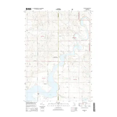
2014 Map of Big Bend
USGS Topo · Published 2014About this map
The Muskegon River defines this portion of the Michigan landscape, flowing southward into the expansive Hardy Dam Pond. This 2014 survey documents a region where the Manistee National Forest meets localized rural settlements and water-based recreation sites. Significant for genealogists and local historians, the map identifies several established burial grounds including Goodwell Cem, Fairview Cem, West Aetna Cem, and Saint Peters Cem, many situated near the small road junctions that knit the countryside together. Recreational hubs such as Oxbow Park and the prominent Big Bend of the river showcase the area's modern land use. The terrain is dotted with numerous kettle lakes and smaller tributaries like Betts Cr and Fivemile Cr, illustrating the glacial hydrology typical of the Newaygo and Mecosta county line.
Find a feature on this map
53 named features on this map. Tap any name to fly to it.
Don’t see what you’re looking for? This feature index may not catch every label — zoom into the map to look around manually.
Map Details
Editions of this 2014 Big Bend Map
This is the sole edition of this map. No revisions or reprints were ever made.
Other maps of this area

1954 · Midland
USGS Topo · 1:250,000

1958 · Midland
USGS Topo · 1:250,000

1958 · Sand Lake
USGS Topo · 1:62,500

1958 · Woodville
USGS Topo · 1:62,500

1958 · Big Rapids
USGS Topo · 1:62,500

1959 · Midland
USGS Topo · 1:250,000

1959 · Howard City
USGS Topo · 1:62,500

1966 · Midland
USGS Topo · 1:250,000

1976 · Big Rapids SW
USGS Topo · 1:24,000
1976 · Howard City NW
USGS Topo · 1:24,000