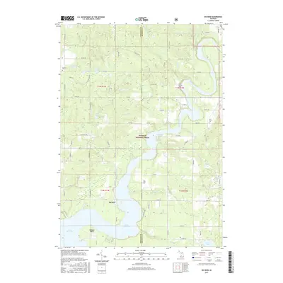
2017 Map of Big Bend
USGS Topo · Published 2017About this map
The Muskegon River meanders through a landscape of glacial lakes and managed woodlands within the Manistee National Forest. This 2017 survey highlights the dramatic serpentine curve of the river at Big Bend, just north of where the waters widen into the Hardy Dam Pond. The map reveals a dispersed rural settlement pattern typical of Newaygo County, punctuated by historic burying grounds like Goodwell Cem, Fairview Cem, and West Aetna Cem.
Find a feature on this map
55 named features on this map. Tap any name to fly to it.
Don’t see what you’re looking for? This feature index may not catch every label — zoom into the map to look around manually.
Map Details
Editions of this 2017 Big Bend Map
This is the sole edition of this map. No revisions or reprints were ever made.
Other maps of this area

1954 · Midland
USGS Topo · 1:250,000

1958 · Midland
USGS Topo · 1:250,000

1958 · Sand Lake
USGS Topo · 1:62,500

1958 · Woodville
USGS Topo · 1:62,500

1958 · Big Rapids
USGS Topo · 1:62,500

1959 · Midland
USGS Topo · 1:250,000

1959 · Howard City
USGS Topo · 1:62,500

1966 · Midland
USGS Topo · 1:250,000

1976 · Big Rapids SW
USGS Topo · 1:24,000
1976 · Howard City NW
USGS Topo · 1:24,000