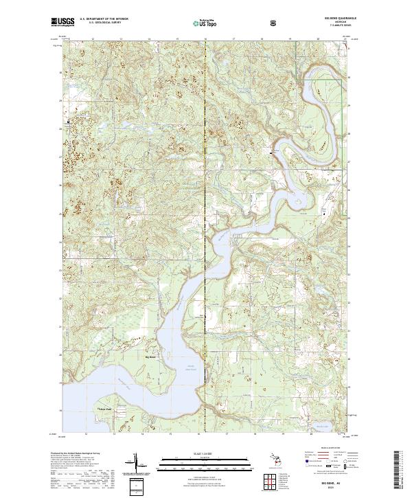
2023 Map of Big Bend
USGS Topo · Published 2023About this map
The Muskegon River meanders through the heart of this landscape, its course widened by the waters of Hardy Dam Pond. This reach of the river, located at the junction of Newaygo and Mecosta Counties, defines a region of dense woodlands within the Manistee National Forest and a high concentration of inland kettle lakes. The settlement of Big Bend sits on the western shore of the reservoir, serving as a focal point for the surrounding rural road network that includes Old State Rd and Newcosta Ave.
Find a feature on this map
56 named features on this map. Tap any name to fly to it.
Don’t see what you’re looking for? This feature index may not catch every label — zoom into the map to look around manually.
Map Details
Editions of this 2023 Big Bend Map
This is the sole edition of this map. No revisions or reprints were ever made.
Other maps of this area

1954 · Midland
USGS Topo · 1:250,000

1958 · Midland
USGS Topo · 1:250,000

1958 · Sand Lake
USGS Topo · 1:62,500

1958 · Woodville
USGS Topo · 1:62,500

1958 · Big Rapids
USGS Topo · 1:62,500

1959 · Midland
USGS Topo · 1:250,000

1959 · Howard City
USGS Topo · 1:62,500

1966 · Midland
USGS Topo · 1:250,000

1976 · Big Rapids SW
USGS Topo · 1:24,000
1976 · Howard City NW
USGS Topo · 1:24,000