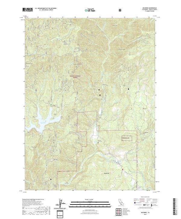
2021 Map of Big Bend
USGS Topo · Published 2021About this map
Big Bend and its surrounding river geography are the focus of this 2021 study of eastern Shasta County. The landscape is defined by the winding course of the Pit River and the thermal activity found at Big Bend Hot Springs and Hunt Hot Spring. For genealogists and local historians, the Big Bend Indian Cem provides a significant cultural anchor near the riverbanks. The high-elevation terrain within the Shasta National Forest is punctuated by numerous named flats, including Arvison Flat, Big Flat, and Nelson Flat, which indicate historical land use patterns in this part of the Cascades. Water management and natural hydrology are prominent, with the Iron Canyon Reservoir collecting various local drainages like Iron Canyon Cr and Cedar Salt Log Cr. The map details a network of forest roads and trails, such as the Stump Creek Trl, that traverse the steep topography between Devils Mtn and Oak Mtn.
Find a feature on this map
61 named features on this map. Tap any name to fly to it.
Don’t see what you’re looking for? This feature index may not catch every label — zoom into the map to look around manually.
Map Details
Editions of this 2021 Big Bend Map
This is the sole edition of this map. No revisions or reprints were ever made.
Other maps of this area

1886 · Lassen Peak
USGS Topo · 1:250,000

1886 · Modoc Lava Bed
USGS Topo · 1:250,000

1886 · Shasta
USGS Topo · 1:250,000

1890 · Red Bluff
USGS Topo · 1:250,000

1892 · Modoc Lava-Bed
USGS Topo · 1:250,000

1892 · Lassen Peak
USGS Topo · 1:250,000

1894 · Lassen Peak
USGS Topo · 1:250,000

1894 · Red Bluff
USGS Topo · 1:250,000

1894 · Shasta
USGS Topo · 1:250,000

1901 · Redding
USGS Topo · 1:125,000