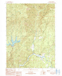
1990 Map of Big Bend
USGS Topo · Published 1990About this map
Big Bend Rancheria and the riverfront settlement of Big Bend anchor this 1990 study of the northern California landscape where the Pit River carves through the Shasta National Forest. The map documents a blend of thermal activity and water management, highlighting Big Bend Hot Springs and Hunt Hot Spring alongside the infrastructure of the Iron Canyon Reservoir. Recreational and historical sites are noted throughout the forest, from Hawkins Landing Campground to the high elevation of Dutchman Peak. Genealogists and local historians can locate specific landmarks like the Indian Springs Sch and a lone Grave near Baker. The terrain is defined by dramatic elevation changes between points like Devils Mountain and the deep cuts of Kosk Creek, illustrating the remote character of Shasta County before the close of the twentieth century.
Find a feature on this map
51 named features on this map. Tap any name to fly to it.
Don’t see what you’re looking for? This feature index may not catch every label — zoom into the map to look around manually.
Map Details
Editions of this 1990 Big Bend Map
This is the sole edition of this map. No revisions or reprints were ever made.
Other maps of this area

1886 · Lassen Peak
USGS Topo · 1:250,000

1886 · Modoc Lava Bed
USGS Topo · 1:250,000

1886 · Shasta
USGS Topo · 1:250,000

1890 · Red Bluff
USGS Topo · 1:250,000

1892 · Modoc Lava-Bed
USGS Topo · 1:250,000

1892 · Lassen Peak
USGS Topo · 1:250,000

1894 · Lassen Peak
USGS Topo · 1:250,000

1894 · Red Bluff
USGS Topo · 1:250,000

1894 · Shasta
USGS Topo · 1:250,000

1901 · Redding
USGS Topo · 1:125,000