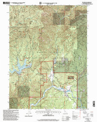
1998 Map of Big Bend
USGS Topo · Published 2003About this map
The Pit River carves a deep path through the Shasta-Trinity National Forest in this 1990s U.S. Forest Service revision. The settlement of Big Bend serves as the focal point of the region, situated near the Big Bend Rancheria and the thermal waters of Big Bend Hot Sprs. To the west, the Iron Canyon Reservoir dominates the drainage of Smith Flat, with recreation marked at the Hawkins Landing Campground.
Find a feature on this map
59 named features on this map. Tap any name to fly to it.
Don’t see what you’re looking for? This feature index may not catch every label — zoom into the map to look around manually.
Map Details
Editions of this 1998 Big Bend Map
This is the sole edition of this map. No revisions or reprints were ever made.
Other maps of this area

1886 · Lassen Peak
USGS Topo · 1:250,000

1886 · Modoc Lava Bed
USGS Topo · 1:250,000

1886 · Shasta
USGS Topo · 1:250,000

1890 · Red Bluff
USGS Topo · 1:250,000

1892 · Modoc Lava-Bed
USGS Topo · 1:250,000

1892 · Lassen Peak
USGS Topo · 1:250,000

1894 · Lassen Peak
USGS Topo · 1:250,000

1894 · Red Bluff
USGS Topo · 1:250,000

1894 · Shasta
USGS Topo · 1:250,000

1901 · Redding
USGS Topo · 1:125,000