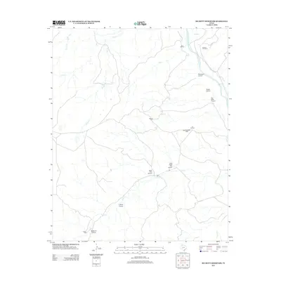
2012 Map of Big Betty Reservoir
USGS Topo · Published 2012About this map
The Prairie Dog Town Fork Red River carves through this northern Texas landscape, defining a network of deep drainages and named breaks in Armstrong County. This 2012 survey documents a ranching-centric geography where infrastructure is tied to water and livestock management. Settlements and operational hubs like Campbell Creek Camp and Cyclone Pens sit alongside numerous cattle pens, including Tule Pens and Eddies Pens, reflecting the ongoing agricultural utility of the land.
Find a feature on this map
24 named features on this map. Tap any name to fly to it.
Don’t see what you’re looking for? This feature index may not catch every label — zoom into the map to look around manually.
Map Details
Editions of this 2012 Big Betty Reservoir Map
This is the sole edition of this map. No revisions or reprints were ever made.
Other maps of this area

1954 · Plainview
USGS Topo · 1:250,000

1958 · Plainview
USGS Topo · 1:250,000

1960 · Indian Peak
USGS Topo · 1:62,500

1963 · Paloduro
USGS Topo · 1:24,000

1963 · Pleasant Creek
USGS Topo · 1:24,000
1963 · Gip Creek
USGS Topo · 1:24,000

1965 · Ross Canyon
USGS Topo · 1:24,000

1965 · Big Betty Reservoir
USGS Topo · 1:24,000

1965 · Vigo Park
USGS Topo · 1:24,000

1965 · Cope Creek
USGS Topo · 1:24,000