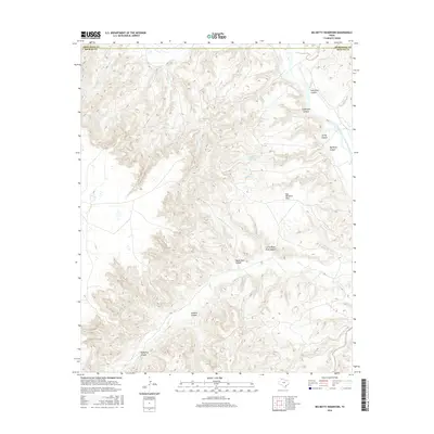
2016 Map of Big Betty Reservoir
USGS Topo · Published 2016About this map
The Prairie Dog Town Fork Red River carves through this portion of the Texas Panhandle, creating a complex landscape of deep-cut drainage systems and high plateaus. At the heart of the terrain is the Big Betty Reservoir, an impoundment fed by Horse Cr and Bear Cr. The map reveals the dramatic topographical shifts where the high plains break into the Caprock escarpment, most notably at the southern edges of the Palo Duro Canyon system and Goodnight Canyon.
Find a feature on this map
20 named features on this map. Tap any name to fly to it.
Don’t see what you’re looking for? This feature index may not catch every label — zoom into the map to look around manually.
Map Details
Editions of this 2016 Big Betty Reservoir Map
This is the sole edition of this map. No revisions or reprints were ever made.
Other maps of this area

1954 · Plainview
USGS Topo · 1:250,000

1958 · Plainview
USGS Topo · 1:250,000

1960 · Indian Peak
USGS Topo · 1:62,500

1963 · Paloduro
USGS Topo · 1:24,000

1963 · Pleasant Creek
USGS Topo · 1:24,000
1963 · Gip Creek
USGS Topo · 1:24,000

1965 · Ross Canyon
USGS Topo · 1:24,000

1965 · Big Betty Reservoir
USGS Topo · 1:24,000

1965 · Vigo Park
USGS Topo · 1:24,000

1965 · Cope Creek
USGS Topo · 1:24,000