
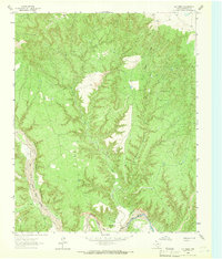
1965 Map of Big Betty Reservoir
USGS Topo · Published 1967About this map
Palo Duro Canyon dominates this 1960s landscape where the Armstrong Co Briscoe Co line cuts through the heart of the Texas Panhandle. The erratic course of the Prairie Dog Town Fork Red River forms the northern boundary, carving a complex network of side canyons including Jersey Canyon, Goodnight Canyon, and Big Betty Canyon. The area is defined by ranching infrastructure and seasonal water sources, featuring numerous named livestock facilities like Cyclone Pens, Tule Pens, and Eddies Pens.
Find a feature on this map
33 named features on this map. Tap any name to fly to it.
Don’t see what you’re looking for? This feature index may not catch every label — zoom into the map to look around manually.
Map Details
Editions of this 1965 Big Betty Reservoir Map
This is the sole edition of this map. No revisions or reprints were ever made.
Other maps of this area

1954 · Plainview
USGS Topo · 1:250,000

1958 · Plainview
USGS Topo · 1:250,000

1960 · Indian Peak
USGS Topo · 1:62,500

1963 · Paloduro
USGS Topo · 1:24,000

1963 · Pleasant Creek
USGS Topo · 1:24,000
1963 · Gip Creek
USGS Topo · 1:24,000

1965 · Ross Canyon
USGS Topo · 1:24,000

1965 · Vigo Park
USGS Topo · 1:24,000

1965 · Cope Creek
USGS Topo · 1:24,000
1976 · Indian Peak SW
USGS Topo · 1:24,000