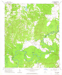
1963 Map of Big Black
USGS Topo · Published 1964About this map
The Big Black River meanders sharply along the border of Warren and Claiborne counties, creating a complex landscape of oxbow lakes and alluvial bottomlands. This 1960s environment is defined by its water-carved geography, featuring named water bodies such as Congo Lake, Regan Lake, and Baker Lake. The land is dotted with small country churches that served rural communities, including Antioch Ch, Rose Hill Ch, and Second Union Ch.
Find a feature on this map
35 named features on this map. Tap any name to fly to it.
Don’t see what you’re looking for? This feature index may not catch every label — zoom into the map to look around manually.
Map Details
Editions of this 1963 Big Black Map
2 editions found
Other maps of this area

1918 · Vicksburg
USGS Topo · 1:62,500

1938 · Edwards
USGS Topo · 1:62,500

1939 · Yokena
USGS Topo · 1:62,500

1941 · Vicksburg
USGS Topo · 1:62,500

1955 · Jackson
USGS Topo · 1:250,000

1961 · Jackson
USGS Topo · 1:250,000

1962 · Jackson
USGS Topo · 1:250,000

1962 · Vicksburg West
USGS Topo · 1:24,000

1962 · Vicksburg East
USGS Topo · 1:24,000

1962 · Utica West
USGS Topo · 1:24,000