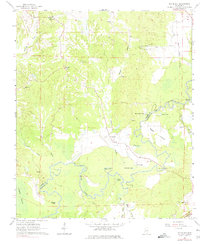
1963 Map of Big Black
USGS Topo · Published 1975About this map
The Big Black River meanders sharply through the bottomlands of the Warren and Claiborne county line, shaping a landscape defined by oxbow lakes and seasonal wetlands. This 1963 survey shows the intricate drainage network where the river creates Regan Island and leaves behind bodies of water like Horseshoe Lake, Congo Lake, and Baker Lake. Along the higher ground, a network of rural churches including Antioch Ch and Goodrum Ch served the local community, while the Old Indian Treaty Boundary remains a surveyed line across the terrain near the Natchez Trace Parkway. The presence of numerous Gravel Pits along the river bluffs near Hamer Bayou points to the local extractive industry of the mid-20th century, providing a detailed look at the rural infrastructure of central Mississippi before modern development changed these river crossings.
Find a feature on this map
33 named features on this map. Tap any name to fly to it.
Don’t see what you’re looking for? This feature index may not catch every label — zoom into the map to look around manually.
Map Details
Editions of this 1963 Big Black Map
2 editions found
Other maps of this area

1918 · Vicksburg
USGS Topo · 1:62,500

1938 · Edwards
USGS Topo · 1:62,500

1939 · Yokena
USGS Topo · 1:62,500

1941 · Vicksburg
USGS Topo · 1:62,500

1955 · Jackson
USGS Topo · 1:250,000

1961 · Jackson
USGS Topo · 1:250,000

1962 · Jackson
USGS Topo · 1:250,000

1962 · Vicksburg West
USGS Topo · 1:24,000

1962 · Vicksburg East
USGS Topo · 1:24,000

1962 · Utica West
USGS Topo · 1:24,000