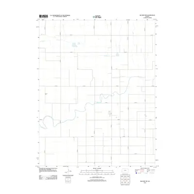
2012 Map of Big Bow NW
USGS Topo · Published 2012About this map
Mitchell Cem serves as a primary genealogical landmark in this section of western Kansas, where the high plains landscape is defined by the winding course of Bear Ck and its northern tributary, Little Bear Cr. The map reveals a strict rectangular grid system of county roads, such as Co Road S and N Road K, which organize the agricultural territory of Stanton County. This spatial pattern illustrates the enduring influence of the Public Land Survey System on the rural landscape, showing how modern transit routes like E Road 4 and E Road 8 continue to follow the original section lines established decades prior. The sparse distribution of structures suggests a region dedicated to large-scale ranching or farming, with drainage patterns around the creek beds providing the only break in the geometric regularity of the plains.
Find a feature on this map
23 named features on this map. Tap any name to fly to it.
Don’t see what you’re looking for? This feature index may not catch every label — zoom into the map to look around manually.
Map Details
Editions of this 2012 Big Bow NW Map
This is the sole edition of this map. No revisions or reprints were ever made.
Other maps of this area

1900 · Syracuse
USGS Topo · 1:125,000

1920 · Syracuse
USGS Topo · 1:125,000

1955 · Dodge City
USGS Topo · 1:250,000

1958 · Dodge City
USGS Topo · 1:250,000

1959 · Dodge City
USGS Topo · 1:250,000

1959 · Big Bow NE
USGS Topo · 1:24,000

1959 · Big Bow NW
USGS Topo · 1:24,000

1959 · Big Bow SW
USGS Topo · 1:24,000
1959 · Big Bow
USGS Topo · 1:24,000

1966 · Syracuse East SW
USGS Topo · 1:24,000