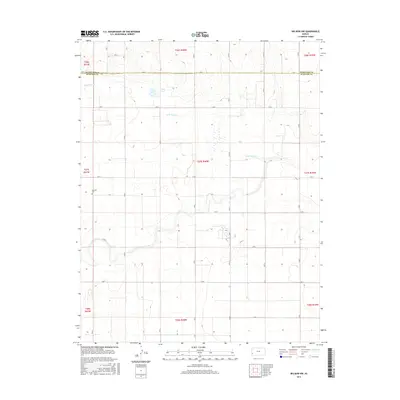
2015 Map of Big Bow NW
USGS Topo · Published 2015About this map
Little Bear Cr wanders through this high plains landscape on the border of Hamilton Co and Stanton Co. The terrain is characterized by the expansive section-line grid typical of Western Kansas, where a network of county roads like RD 37 and Co RD T define the rural agricultural plots. A notable point of interest for local historians is the Mitchell Cem, a quiet landmark situated near the western edge of the quadrangle. This 2015 survey illustrates how modern infrastructure and legacy landmarks coexist in this remote corner of the state, where the drainage of the creek provides the primary topographic variation across the townships.
Find a feature on this map
33 named features on this map. Tap any name to fly to it.
Don’t see what you’re looking for? This feature index may not catch every label — zoom into the map to look around manually.
Map Details
Editions of this 2015 Big Bow NW Map
This is the sole edition of this map. No revisions or reprints were ever made.
Other maps of this area

1900 · Syracuse
USGS Topo · 1:125,000

1920 · Syracuse
USGS Topo · 1:125,000

1955 · Dodge City
USGS Topo · 1:250,000

1958 · Dodge City
USGS Topo · 1:250,000

1959 · Dodge City
USGS Topo · 1:250,000

1959 · Big Bow NE
USGS Topo · 1:24,000

1959 · Big Bow NW
USGS Topo · 1:24,000

1959 · Big Bow SW
USGS Topo · 1:24,000
1959 · Big Bow
USGS Topo · 1:24,000

1966 · Syracuse East SW
USGS Topo · 1:24,000