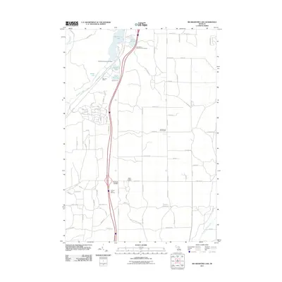
2011 Map of Big Bradford Lake
USGS Topo · Published 2011About this map
Hartwick Pines State Park and the surrounding woodlands of Crawford County define this landscape, where outdoor recreation and conservation intersect. The map highlights numerous glacial water bodies including Big Bradford Lake, Lake Marjory, and Blue Gill Lake, which support seasonal residences and visitors at sites like Headwaters Camping and Cabins. Local governance and community history are anchored at the Maple Forest Township Hall and the nearby Maple Forest Cemetery. A transportation corridor follows the path of Old US Hwy 27 S and Pipeline Rd, cutting a north-south line through the timberland. At Forbush Corner, travelers find a notable junction near the Hartwick Pines Rest Area. Further southeast, the terrain gives way to the drainage of the East Branch Au Sable River, a critical waterway for the region's natural ecosystem.
Find a feature on this map
82 named features on this map. Tap any name to fly to it.
Don’t see what you’re looking for? This feature index may not catch every label — zoom into the map to look around manually.
Map Details
Editions of this 2011 Big Bradford Lake Map
This is the sole edition of this map. No revisions or reprints were ever made.
Other maps of this area

1949 · Otsego Lake
USGS Topo · 1:62,500

1949 · Fletcher
USGS Topo · 1:62,500

1949 · Grayling
USGS Topo · 1:62,500

1950 · Lake Margrethe
USGS Topo · 1:24,000

1950 · Grayling
USGS Topo · 1:24,000

1950 · Turtle Lake
USGS Topo · 1:24,000

1951 · K P Lake
USGS Topo · 1:24,000

1951 · Big Bradford Lake
USGS Topo · 1:24,000

1951 · Wakeley Lake
USGS Topo · 1:24,000

1951 · Grayling
USGS Topo · 1:24,000
Featured Places
- Maple Forest Township, MI
- Forbush Corner, MI
- Frederic Township, MI
- Hayes Township, MI
- Grayling Charter Township, MI