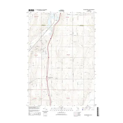
2014 Map of Big Bradford Lake
USGS Topo · Published 2014About this map
The boundary between Otsego Co and Crawford Co cuts through a landscape defined by glacial lakes and the headwaters of the E Br Au Sable River. The small settlement of Forbush Corner serves as a central landmark for this northern Michigan woodland, situated near the Maple Forest Cem. A complex network of recreation and logging trails, including the Au Sable Trl and Hayesego Trl, weaves between significant water bodies such as Big Bradford Lake, Lake Marjory, and the smaller Horseshoe Lake. The layout of the roads, such as N Old US-27 and Pipeline Rd, illustrates the evolution of regional transportation from early highway corridors to modern interstate infrastructure, while the hydrography of Bradford Cr and Kolke Cr highlights the area's role as a vital watershed.
Find a feature on this map
88 named features on this map. Tap any name to fly to it.
Don’t see what you’re looking for? This feature index may not catch every label — zoom into the map to look around manually.
Map Details
Editions of this 2014 Big Bradford Lake Map
This is the sole edition of this map. No revisions or reprints were ever made.
Other maps of this area

1949 · Otsego Lake
USGS Topo · 1:62,500

1949 · Fletcher
USGS Topo · 1:62,500

1949 · Grayling
USGS Topo · 1:62,500

1950 · Lake Margrethe
USGS Topo · 1:24,000

1950 · Grayling
USGS Topo · 1:24,000

1950 · Turtle Lake
USGS Topo · 1:24,000

1951 · K P Lake
USGS Topo · 1:24,000

1951 · Big Bradford Lake
USGS Topo · 1:24,000

1951 · Wakeley Lake
USGS Topo · 1:24,000

1951 · Grayling
USGS Topo · 1:24,000
Featured Places
- Maple Forest Township, MI
- Forbush Corner, MI
- Frederic Township, MI
- Hayes Township, MI
- Grayling Charter Township, MI