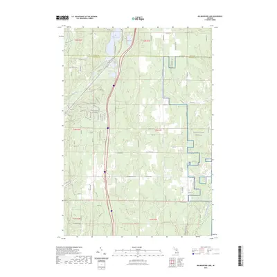
2023 Map of Big Bradford Lake
USGS Topo · Published 2023About this map
Big Bradford Lake and Lake Marjory define the northern hydrology of this Crawford County terrain, where the boundary between Otsego and Crawford counties cuts through a landscape of dense glacial lakes and forest trails. The presence of Maple Forest Cem near the center of the sheet provides a fixed point for genealogists researching the rural communities that once congregated around these wooded uplands. In the eastern reaches, the NG MTC-H Camp Grayling military installation occupies a significant portion of the land, illustrating the region's long-standing role in defense training.
Find a feature on this map
100 named features on this map. Tap any name to fly to it.
Don’t see what you’re looking for? This feature index may not catch every label — zoom into the map to look around manually.
Map Details
Editions of this 2023 Big Bradford Lake Map
This is the sole edition of this map. No revisions or reprints were ever made.
Other maps of this area

1949 · Otsego Lake
USGS Topo · 1:62,500

1949 · Fletcher
USGS Topo · 1:62,500

1949 · Grayling
USGS Topo · 1:62,500

1950 · Lake Margrethe
USGS Topo · 1:24,000

1950 · Grayling
USGS Topo · 1:24,000

1950 · Turtle Lake
USGS Topo · 1:24,000

1951 · K P Lake
USGS Topo · 1:24,000

1951 · Big Bradford Lake
USGS Topo · 1:24,000

1951 · Wakeley Lake
USGS Topo · 1:24,000

1951 · Grayling
USGS Topo · 1:24,000
Featured Places
- Otsego Lake Township, MI
- Grayling Charter Township, MI
- Maple Forest Township, MI
- Forbush Corner, MI
- Frederic Township, MI