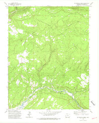
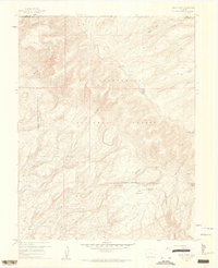
1973 Map of Big Bucktail Creek
USGS Topo · Published 1975About this map
The San Miguel River carves through the southern reaches of this landscape, its waters diverted by a complex network of irrigation infrastructure including the C. C. Ditch, Parkway Ditch, and Doing Ditch. This 1973 field-checked survey reveals the high-plateau geography of the Uncompahgre National Forest, where steep drainages like Coal Canyon and Robbers Roost Canyon descend toward the river valley.
Find a feature on this map
26 named features on this map. Tap any name to fly to it.
Don’t see what you’re looking for? This feature index may not catch every label — zoom into the map to look around manually.
Map Details
Editions of this 1973 Big Bucktail Creek Map
2 editions found
Other maps of this area

1916 · Paradox Valley
USGS Topo · 1:125,000

1922 · Paradox Valley
USGS Topo · 1:125,000

1956 · Moab
USGS Topo · 1:250,000

1959 · Moab
USGS Topo · 1:250,000

1960 · Moab
USGS Topo · 1:250,000
1960 · Nucla
USGS Topo · 1:24,000
1960 · Nucla
USGS Topo · 1:62,500
1960 · Windy Point
USGS Topo · 1:24,000

1962 · Moab
USGS Topo · 1:250,000

1964 · Moab
USGS Topo · 1:250,000