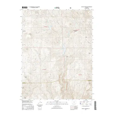
2016 Map of Big Bull Mountain
USGS Topo · Published 2016About this map
Goldfield occupies a high-elevation plateau in the northwest corner of this Colorado landscape, marking a legacy of mountain settlement at the edge of the Pike National Forest. The terrain is defined by a series of significant peaks and drainages, including Big Bull Mountain and Brind Mtn, which tower over the deep winding recesses of Phantom Canyon. Water management is central to the area's geography, with the Pringtime Reservoir and Skaguay Reservoir capturing the flow of W Beaver Cr and its tributaries. The map traces the historical path of the Gold Camp Rd and various forest routes like Co RD 861, which navigate the complex topography of Douglas Gulch and Hopkins Gulch. This survey captures the transition from Teller County into Fremont County, illustrating the remote infrastructure of the region as it appeared in the early 21st century.
Find a feature on this map
39 named features on this map. Tap any name to fly to it.
Don’t see what you’re looking for? This feature index may not catch every label — zoom into the map to look around manually.
Map Details
Editions of this 2016 Big Bull Mountain Map
This is the sole edition of this map. No revisions or reprints were ever made.
Other maps of this area

1893 · Colorado Springs
USGS Topo · 1:125,000

1894 · Pikes Peak
USGS Topo · 1:125,000

1901 · Pikes Peak
USGS Topo · 1:125,000

1901 · Pikes Peak
USGS Topo · 1:62,500

1909 · Colorado Springs
USGS Topo · 1:125,000

1942 · Colorado Springs
USGS Topo · 1:125,000

1948 · Mount Big Chief
USGS Topo · 1:24,000

1948 · Mount Pittsburg
USGS Topo · 1:24,000

1948 · Manitou Springs
USGS Topo · 1:24,000

1948 · Colorado Springs
USGS Topo · 1:62,500