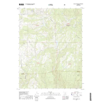
2019 Map of Big Bull Mountain
USGS Topo · Published 2019About this map
Pike National Forest dominates the high-elevation landscape of this 2019 survey, where the border of Teller and Fremont counties meets among prominent peaks and deep gulches. The terrain is defined by massive formations such as Big Bull Mtn and Brind Mtn, while Phantom Canyon Road winds through the southern reaches of the map near Nipple Mtn. A complex drainage system feeds the regional watershed, including Middle Beaver Cr, Eightmile Cr, and the waters of Pringtime Reservoir. The map illustrates a high-altitude network of forestry roads and trails, notably the Ring the Peak trail and Gold Camp Rd, which reflect the area's legacy of mountain transit and resource management. Deep incisions like Douglas Gulch and Hopkins Gulch carve through the forested slopes, providing a detailed look at the geographic character of this section of the Front Range.
Find a feature on this map
40 named features on this map. Tap any name to fly to it.
Don’t see what you’re looking for? This feature index may not catch every label — zoom into the map to look around manually.
Map Details
Editions of this 2019 Big Bull Mountain Map
This is the sole edition of this map. No revisions or reprints were ever made.
Other maps of this area

1893 · Colorado Springs
USGS Topo · 1:125,000

1894 · Pikes Peak
USGS Topo · 1:125,000

1901 · Pikes Peak
USGS Topo · 1:125,000

1901 · Pikes Peak
USGS Topo · 1:62,500

1909 · Colorado Springs
USGS Topo · 1:125,000

1942 · Colorado Springs
USGS Topo · 1:125,000

1948 · Mount Big Chief
USGS Topo · 1:24,000

1948 · Mount Pittsburg
USGS Topo · 1:24,000

1948 · Manitou Springs
USGS Topo · 1:24,000

1948 · Colorado Springs
USGS Topo · 1:62,500