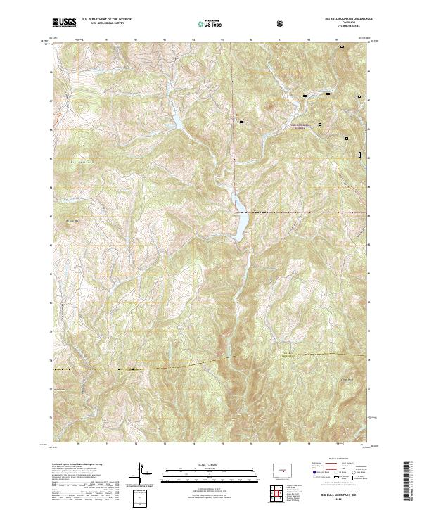
2022 Map of Big Bull Mountain
USGS Topo · Published 2022About this map
Pike National Forest dominates this high-altitude landscape where the southern border of Teller Co meets Fremont Co. The terrain is defined by a series of prominent peaks and drainage systems, including Big Bull Mtn, Brind Mtn, and the distinctive Nipple Mtn. Water management is evident at Pringtime Reservoir, which feeds into the complex network of Willow Cr and Middle Beaver Cr. The map reveals a transition from these high summits down into the dramatic geography of Phantom Canyon in the southwest. A network of historic thoroughfares, such as Gold Camp Rd and Beaver Valley RD, provides access through the gulches and along the creek beds, tracing the routes once vital for mountain commerce and transit between regional mining hubs.
Find a feature on this map
38 named features on this map. Tap any name to fly to it.
Don’t see what you’re looking for? This feature index may not catch every label — zoom into the map to look around manually.
Map Details
Editions of this 2022 Big Bull Mountain Map
This is the sole edition of this map. No revisions or reprints were ever made.
Other maps of this area

1893 · Colorado Springs
USGS Topo · 1:125,000

1894 · Pikes Peak
USGS Topo · 1:125,000

1901 · Pikes Peak
USGS Topo · 1:125,000

1901 · Pikes Peak
USGS Topo · 1:62,500

1909 · Colorado Springs
USGS Topo · 1:125,000

1942 · Colorado Springs
USGS Topo · 1:125,000

1948 · Mount Big Chief
USGS Topo · 1:24,000

1948 · Mount Pittsburg
USGS Topo · 1:24,000

1948 · Manitou Springs
USGS Topo · 1:24,000

1948 · Colorado Springs
USGS Topo · 1:62,500