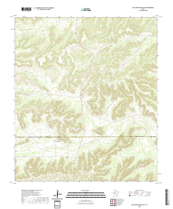
2022 Map of Big Canyon Ranch SW
USGS Topo · Published 2022About this map
The arid ranchlands of the Trans-Pecos region are defined by the convergence of ephemeral drainages and lonely ranch corridors along the Pecos and Terrell County line. This remote landscape is characterized by the complex topography of the Edwards Plateau, where seasonal runoff carved features like Clark Place Draw, Fortyone Draw, and the southern expanse of Downie Draw. The sparse infrastructure of the 2020s reflects a traditional West Texas pastoral economy, with access provided by Ranch Rd 2400, Stegall Rd, and the historic path of Old Downie Rd. The map serves as a precise record of the rugged relief and drainage patterns essential for land management and water tracing in this high-desert environment.
Find a feature on this map
7 named features on this map. Tap any name to fly to it.
Don’t see what you’re looking for? This feature index may not catch every label — zoom into the map to look around manually.
Map Details
Editions of this 2022 Big Canyon Ranch SW Map
This is the sole edition of this map. No revisions or reprints were ever made.
Other maps of this area

1920 · Longfellow
USGS Topo · 1:125,000

1928 · Sanderson
USGS Topo · 1:125,000

1954 · Fort Stockton
USGS Topo · 1:250,000

1958 · Fort Stockton
USGS Topo · 1:250,000

1968 · Busher Canyon
USGS Topo · 1:24,000

1968 · Toms Canyon
USGS Topo · 1:24,000

1968 · Ninemile Ranch
USGS Topo · 1:24,000

1969 · Sanderson
USGS Topo · 1:24,000

1969 · Big Canyon Ranch
USGS Topo · 1:24,000

1969 · Big Canyon Ranch NW
USGS Topo · 1:24,000