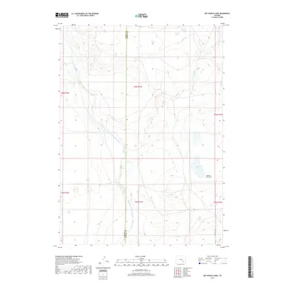
2017 Map of Big Charlie Lakes
USGS Topo · Published 2017About this map
The Little Medicine Bow River meanders across this high-plains landscape, crossing the line between Carbon and Albany counties. This high-altitude drainage is defined by the winding course of Spring Cr and the seasonal depressions of Johnson Flat Draw, which feed into the central basin. The namesake Big Charlie Lakes appear as a cluster of wetlands and ponds in the southeastern portion of the survey, a critical water source in this semi-arid region. Apart from the isolated track of Marshall Rd in the lower corner, the map shows a landscape dominated by the Public Land Survey System grid and the natural contours of the river valley, offering a precise view of the hydrology and terrain before modern development altered the drainage patterns.
Find a feature on this map
12 named features on this map. Tap any name to fly to it.
Don’t see what you’re looking for? This feature index may not catch every label — zoom into the map to look around manually.
Map Details
Editions of this 2017 Big Charlie Lakes Map
This is the sole edition of this map. No revisions or reprints were ever made.
Other maps of this area

1954 · Torrington
USGS Topo · 1:250,000

1955 · Casper
USGS Topo · 1:250,000

1958 · Casper
USGS Topo · 1:250,000

1958 · Torrington
USGS Topo · 1:250,000

1959 · Moss Agate Reservoir
USGS Topo · 1:24,000

1959 · Chalk Hills
USGS Topo · 1:24,000
1961 · Walker Draw SE
USGS Topo · 1:24,000

1961 · T B Ranch
USGS Topo · 1:24,000
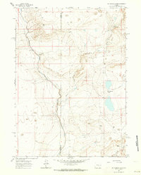
1961 · Big Charlie Lakes
USGS Topo · 1:24,000
1961 · Walker Draw NW
USGS Topo · 1:24,000