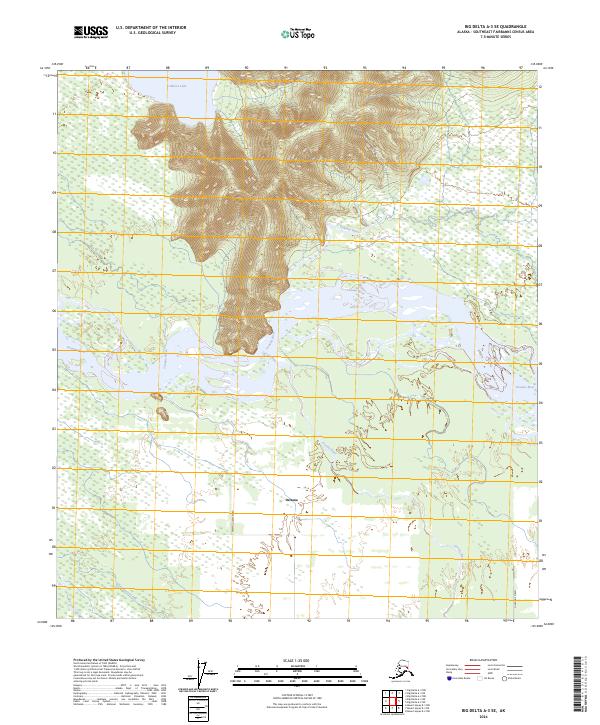
2024 Map of Big Delta A-3 SE
USGS Topo · Published 2024About this map
The Tanana River dominates this interior Alaska landscape, carving a wide alluvial corridor through the Southeast Fairbanks region. To the south, the settlement of Deltana sits within a complex network of braided streams and wetlands, where the Gerstle River and Clearwater Creek converge toward the main river valley. This 2024 survey captures the modern infrastructure supporting this remote community, including Sammill Creek Road and Cummings Street.
Find a feature on this map
12 named features on this map. Tap any name to fly to it.
Don’t see what you’re looking for? This feature index may not catch every label — zoom into the map to look around manually.
Map Details
Editions of this 2024 Big Delta A-3 SE Map
This is the sole edition of this map. No revisions or reprints were ever made.
Other maps of this area

1950 · Mount Hayes
USGS Topo · 1:250,000

1950 · Big Delta
USGS Topo · 1:250,000

1951 · Big Delta
USGS Topo · 1:250,000

1951 · Mount Hayes
USGS Topo · 1:250,000

1954 · Mount Hayes D-2
USGS Topo · 1:63,360

1954 · Mount Hayes D-3
USGS Topo · 1:63,360

1954 · Big Delta A-2
USGS Topo · 1:63,360

1955 · Big Delta A-3
USGS Topo · 1:63,360

1955 · Big Delta A-2
USGS Topo · 1:63,360

1955 · Mount Hayes D-2
USGS Topo · 1:63,360