
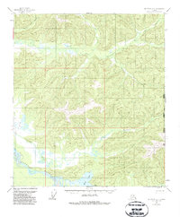
1955 Map of Big Delta A-2
USGS Topo · Published 1962About this map
Indian Village sits along the southern edge of this interior Alaskan landscape, positioned near the confluence where the Healy River meets the expansive Tanana River. The map captures a wilderness environment defined by complex hydrology, dominated by the Volkmar River and the braided channels of the Tanana. A notable seasonal route, the Winter Trail, cuts across the northern terrain, indicating the historical importance of sledge and overland travel through this remote subarctic region before more permanent road infrastructure was established.
Find a feature on this map
13 named features on this map. Tap any name to fly to it.
Don’t see what you’re looking for? This feature index may not catch every label — zoom into the map to look around manually.
Map Details
Editions of this 1955 Big Delta A-2 Map
2 editions found
Other maps of this area

1950 · Mount Hayes
USGS Topo · 1:250,000

1950 · Big Delta
USGS Topo · 1:250,000

1951 · Big Delta
USGS Topo · 1:250,000

1951 · Mount Hayes
USGS Topo · 1:250,000

1954 · Mount Hayes D-2
USGS Topo · 1:63,360

1954 · Mount Hayes D-3
USGS Topo · 1:63,360

1954 · Mount Hayes D-1
USGS Topo · 1:63,360

1954 · Big Delta A-2
USGS Topo · 1:63,360

1955 · Big Delta A-3
USGS Topo · 1:63,360

1955 · Big Delta A-1
USGS Topo · 1:63,360