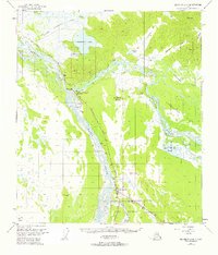
1955 Map of Big Delta A-3
USGS Topo · Published 1958About this map
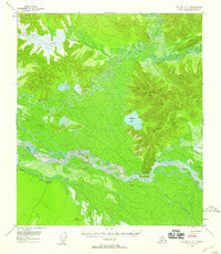
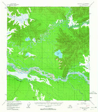
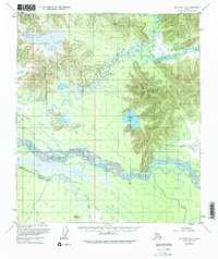
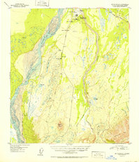
The Tanana River dominates this mid-1950s interior Alaska landscape, weaving a complex braided network through the valley floor. In a region defined by its watercourses, the Goodpaster River and Volkmar River flow from the northern hills toward the extensive Goodpaster Flats. Human presence is sparse and seasonal, represented by several small Cabin sites and the more established Clearwater Ranch near the Campground south of the main river.
Find a feature on this map
18 named features on this map. Tap any name to fly to it.
Don’t see what you’re looking for? This feature index may not catch every label — zoom into the map to look around manually.
Map Details
Editions of this 1955 Big Delta A-3 Map
4 editions found

Other maps of this area

1950 · Mount Hayes
USGS Topo · 1:250,000
1950 · Big Delta
USGS Topo · 1:250,000

1950 · Mount Hayes D-4
USGS Topo · 1:63,360
1950 · Big Delta A-4
USGS Topo · 1:63,360
1950 · Big Delta B-4
USGS Topo · 1:63,360
1951 · Big Delta
USGS Topo · 1:250,000
1951 · Mount Hayes
USGS Topo · 1:250,000
1952 · Mount Hayes D-4
USGS Topo · 1:63,360
1952 · Big Delta A-4
USGS Topo · 1:63,360
1953 · Big Delta B-4
USGS Topo · 1:63,360