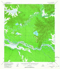
1955 Map of Big Delta A-3
USGS Topo · Published 1964About this map
Tanana River and its intricate braid of channels dominate this mid-century interior Alaskan landscape, where the confluence of the Gerstle River and Clearwater creek meet the primary waterway. The mapping captures a network of seasonal access routes and remote outposts, including several Cabins and the Clearwater Ranch located south of the main river fork. To the north, the Goodpaster River meanders through the Goodpaster Flats, a broad marshy basin punctuated by Liscum Slough and surrounded by prominent landmarks like Volkmar Lake.
Find a feature on this map
20 named features on this map. Tap any name to fly to it.
Don’t see what you’re looking for? This feature index may not catch every label — zoom into the map to look around manually.
Map Details
Editions of this 1955 Big Delta A-3 Map
4 editions found

Other maps of this area

1950 · Mount Hayes
USGS Topo · 1:250,000

1950 · Big Delta
USGS Topo · 1:250,000

1950 · Mount Hayes D-4
USGS Topo · 1:63,360

1950 · Big Delta A-4
USGS Topo · 1:63,360

1950 · Big Delta B-4
USGS Topo · 1:63,360

1951 · Big Delta
USGS Topo · 1:250,000

1951 · Mount Hayes
USGS Topo · 1:250,000

1952 · Mount Hayes D-4
USGS Topo · 1:63,360

1952 · Big Delta A-4
USGS Topo · 1:63,360

1953 · Big Delta B-4
USGS Topo · 1:63,360