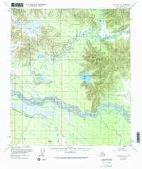
1955 Map of Big Delta A-3
USGS Topo · Published 1976About this map
The Tanana River dominates this interior Alaskan landscape, carving a braided path through a complex network of wetlands and low-lying plains. Surveyed in the mid-1950s, the map reveals a remote territory defined by its watercourses, including the Clearwater River and the meandering South Fork Goodpaster River. The presence of several isolated Cabin sites and the Clearwater Ranch suggest a sparse human footprint centered on river access and seasonal subsistence.
Find a feature on this map
18 named features on this map. Tap any name to fly to it.
Don’t see what you’re looking for? This feature index may not catch every label — zoom into the map to look around manually.
Map Details
Editions of this 1955 Big Delta A-3 Map
4 editions found

Other maps of this area

1950 · Mount Hayes
USGS Topo · 1:250,000

1950 · Big Delta
USGS Topo · 1:250,000

1950 · Mount Hayes D-4
USGS Topo · 1:63,360

1950 · Big Delta A-4
USGS Topo · 1:63,360

1950 · Big Delta B-4
USGS Topo · 1:63,360

1951 · Big Delta
USGS Topo · 1:250,000

1951 · Mount Hayes
USGS Topo · 1:250,000

1952 · Mount Hayes D-4
USGS Topo · 1:63,360

1952 · Big Delta A-4
USGS Topo · 1:63,360

1953 · Big Delta B-4
USGS Topo · 1:63,360