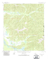
1955 Map of Big Delta A-2
USGS Topo · Published 1985About this map
Indian Village rests along the northern shore of Healy Lake, serving as a focal point for settlement in this interior Alaskan landscape during the mid-1950s. The region is defined by the braided path of the Tanana River and its numerous tributaries, including the Healy River and the Volkmar River. The drainage patterns suggest a complex watershed where White Creek and Swede Creek feed into the South Fork Goodpaster River, while Michigan Creek carves through the eastern highlands.
Find a feature on this map
13 named features on this map. Tap any name to fly to it.
Don’t see what you’re looking for? This feature index may not catch every label — zoom into the map to look around manually.
Map Details
Editions of this 1955 Big Delta A-2 Map
2 editions found

Other maps of this area

1950 · Mount Hayes
USGS Topo · 1:250,000

1950 · Big Delta
USGS Topo · 1:250,000

1951 · Big Delta
USGS Topo · 1:250,000

1951 · Mount Hayes
USGS Topo · 1:250,000

1954 · Mount Hayes D-2
USGS Topo · 1:63,360

1954 · Mount Hayes D-3
USGS Topo · 1:63,360

1954 · Mount Hayes D-1
USGS Topo · 1:63,360

1954 · Big Delta A-2
USGS Topo · 1:63,360

1955 · Big Delta A-3
USGS Topo · 1:63,360

1955 · Big Delta A-1
USGS Topo · 1:63,360