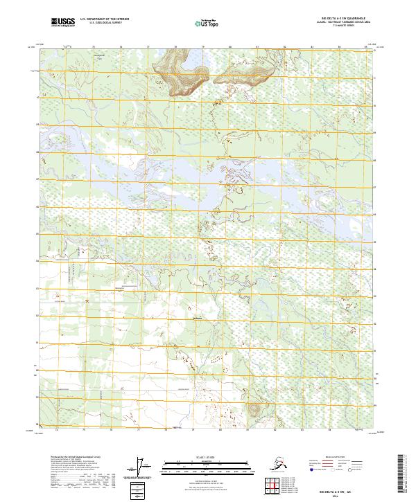
2024 Map of Big Delta A-3 SW
USGS Topo · Published 2024About this map
Tanana River braids through the landscape of the Deltana area, defining a region where glacial waters meet a burgeoning network of homestead roads. The presence of Remington Field and a dense concentration of local thoroughfares like Nistler Road and Keaster Road indicates a transitioned land use from wilderness to active rural settlement. North of the river, the Goodpaster Flats suggest a different terrain character, likely more prone to the shifting courses of the silt-heavy waterways. The intricate hydrology, including the clear flows of Clearwater Creek and the southern reach of Sawmill Creek, illustrates the essential relationship between the local geography and the residential development pattern near the Alaska Highway corridor.
Find a feature on this map
22 named features on this map. Tap any name to fly to it.
Don’t see what you’re looking for? This feature index may not catch every label — zoom into the map to look around manually.
Map Details
Editions of this 2024 Big Delta A-3 SW Map
This is the sole edition of this map. No revisions or reprints were ever made.
Other maps of this area

1950 · Mount Hayes
USGS Topo · 1:250,000

1950 · Big Delta
USGS Topo · 1:250,000

1950 · Mount Hayes D-4
USGS Topo · 1:63,360

1950 · Big Delta A-4
USGS Topo · 1:63,360

1951 · Big Delta
USGS Topo · 1:250,000

1951 · Mount Hayes
USGS Topo · 1:250,000

1952 · Mount Hayes D-4
USGS Topo · 1:63,360

1952 · Big Delta A-4
USGS Topo · 1:63,360

1954 · Mount Hayes D-3
USGS Topo · 1:63,360

1955 · Big Delta A-3
USGS Topo · 1:63,360