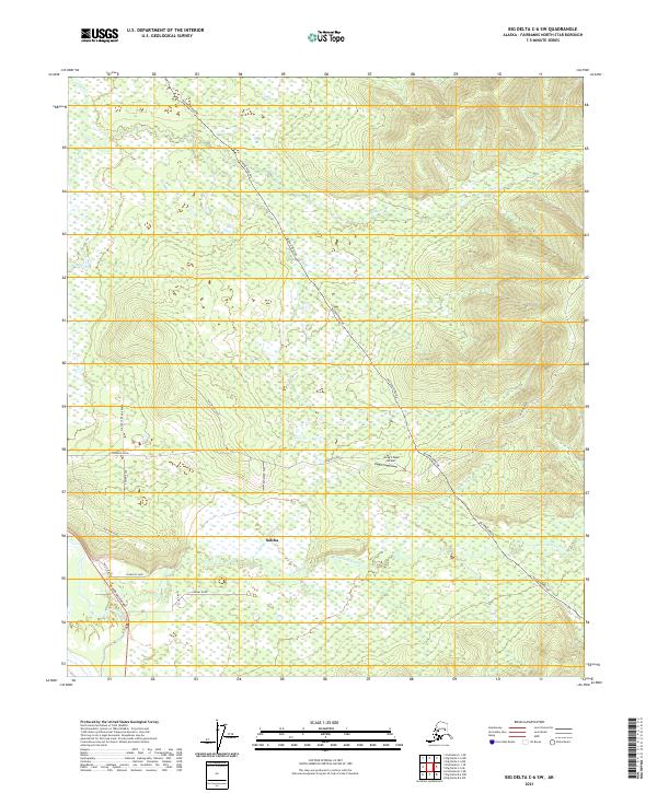
2021 Map of Big Delta C-6 SW
USGS Topo · Published 2021About this map
Salcha serves as the primary settlement hub in this interior Alaska landscape, situated where the Richardson Highway meets a network of local roads. The area's modern infrastructure is defined by the massive corridor of the Alaska Pipeline, which cuts a diagonal path across the terrain from northwest to southeast. The natural drainage of the Little Salcha River and French Cr shapes the lowland topography, providing a stark contrast to the surveyed township lines of the Fairbanks North Star Borough. Local aviation and transport are represented by the Greg'n Sage Airport and a series of rural routes including Johnson Road and Foster Road. The presence of the Military Pipeline Road and Old Site Road suggests layers of historical transit and land use in this subarctic environment.
Find a feature on this map
22 named features on this map. Tap any name to fly to it.
Don’t see what you’re looking for? This feature index may not catch every label — zoom into the map to look around manually.
Map Details
Editions of this 2021 Big Delta C-6 SW Map
This is the sole edition of this map. No revisions or reprints were ever made.
Other maps of this area

1949 · Big Delta B-6
USGS Topo · 1:63,360

1949 · Fairbanks C-1
USGS Topo · 1:63,360

1949 · Big Delta C-6
USGS Topo · 1:63,360

1950 · Fairbanks
USGS Topo · 1:250,000

1950 · Big Delta
USGS Topo · 1:250,000

1950 · Fairbanks C-1
USGS Topo · 1:63,360

1950 · Fairbanks B-1
USGS Topo · 1:63,360

1951 · Big Delta
USGS Topo · 1:250,000
1951 · Fairbanks B-1
USGS Topo · 1:63,360

1951 · Fairbanks
USGS Topo · 1:250,000