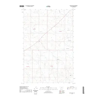
2020 Map of Big Dry School
USGS Topo · Published 2020About this map
Big Dry School stands as a central landmark in this sparse Garfield County landscape, situated where Dutton Rd intersects the local drainage network. The terrain is defined by the winding course of Big Dry Cr and its many tributary coulees, which carve deep channels through the plains. The map records several named geographical features, including Long Coulee and McClay Coulee in the north, and Harston Coulee to the southeast. These family-named landforms and the placement of the schoolhouse suggest a history of ranching and rural education in a territory where settlement follows the available water and road access, such as Steve's Fork Rd. The sparse density of structures emphasizes the isolated character of this region of Montana.
Find a feature on this map
13 named features on this map. Tap any name to fly to it.
Don’t see what you’re looking for? This feature index may not catch every label — zoom into the map to look around manually.
Map Details
Editions of this 2020 Big Dry School Map
This is the sole edition of this map. No revisions or reprints were ever made.
Other maps of this area

1954 · Jordan
USGS Topo · 1:250,000

1956 · Jordan
USGS Topo · 1:250,000

1958 · Jordan
USGS Topo · 1:250,000

1964 · Jordan
USGS Topo · 1:250,000

1965 · Robertson School
USGS Topo · 1:24,000

1965 · Big Dry School
USGS Topo · 1:24,000

1965 · Edwards
USGS Topo · 1:24,000

1965 · Ziegele Coulee
USGS Topo · 1:24,000
1965 · Fig Mountain
USGS Topo · 1:24,000
1965 · Van Dusen Spring
USGS Topo · 1:24,000