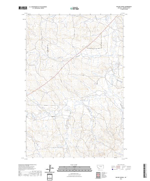
2024 Map of Big Dry School
USGS Topo · Published 2024About this map
Big Dry Creek winds through the dissected breaks of Garfield County, creating a complex network of drainages and seasonal watercourses. This map of the high plains landscape shows a region defined by extensive erosion patterns, where Long Coulee and Sloan Coulee carve deep into the plateau between the forks of the river. The terrain is characterized by these intricate coulee systems, including McClay Coulee and Graham Coulee, which serve as primary topographic landmarks in a landscape with few permanent structures. Human presence is marked by the remote corridors of Steve's Fork Rd and Dutton Rd, which follow the higher ground and ridges to navigate the broken country. This modern survey provides an accurate view of the drainage basins and the Public Land Survey System boundaries, specifically within township ranges like T17N R36E and T16N R35E.
Find a feature on this map
11 named features on this map. Tap any name to fly to it.
Don’t see what you’re looking for? This feature index may not catch every label — zoom into the map to look around manually.
Map Details
Editions of this 2024 Big Dry School Map
This is the sole edition of this map. No revisions or reprints were ever made.
Other maps of this area

1954 · Jordan
USGS Topo · 1:250,000

1956 · Jordan
USGS Topo · 1:250,000

1958 · Jordan
USGS Topo · 1:250,000

1964 · Jordan
USGS Topo · 1:250,000

1965 · Robertson School
USGS Topo · 1:24,000

1965 · Big Dry School
USGS Topo · 1:24,000

1965 · Edwards
USGS Topo · 1:24,000

1965 · Ziegele Coulee
USGS Topo · 1:24,000
1965 · Fig Mountain
USGS Topo · 1:24,000
1965 · Van Dusen Spring
USGS Topo · 1:24,000