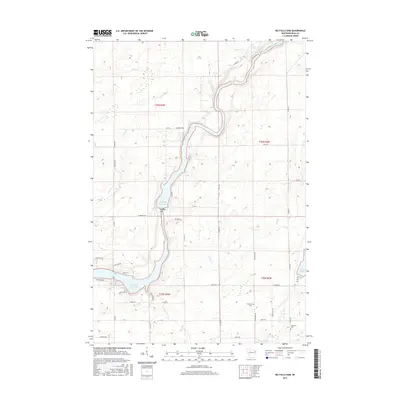
2015 Map of Big Falls Dam
USGS Topo · Published 2015About this map
The Flambeau River defines this portion of Rusk County, where industrial hydroelectric development and natural waterways converge. The landscape is dominated by the Big Falls Flowage, created by the Big Falls Dam, and the larger Dairyland Reservoir to the south. These impoundments sit alongside older river features like Beaver Dam Rapids and Little Cedar Rapids, illustrating the transition of the river from a wild northern waterway to a harnessed power source. Away from the riverbanks, the terrain is shaped by a network of creeks including Stony Cr and Crooked Cr, alongside significant wetlands such as Big Swamp. For local historians and genealogists, the map preserves the locations of the Swedish Cem and Glenview Cem, as well as a rural road network including Mae West Rd and Flambeau Rd.
Find a feature on this map
45 named features on this map. Tap any name to fly to it.
Don’t see what you’re looking for? This feature index may not catch every label — zoom into the map to look around manually.
Map Details
Editions of this 2015 Big Falls Dam Map
This is the sole edition of this map. No revisions or reprints were ever made.
Other maps of this area

1944 · Exeland
USGS Topo · 1:48,000

1945 · Ingram
USGS Topo · 1:48,000

1947 · Exeland
USGS Topo · 1:48,000

1947 · Ingram
USGS Topo · 1:48,000

1947 · Sheldon
USGS Topo · 1:48,000

1948 · Ladysmith
USGS Topo · 1:48,000

1949 · Sheldon
USGS Topo · 1:48,000

1950 · Ladysmith
USGS Topo · 1:48,000

1953 · Rice Lake
USGS Topo · 1:250,000

1959 · Rice Lake
USGS Topo · 1:250,000