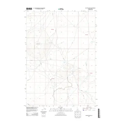
2013 Map of Big Foot Butte
USGS Topo · Published 2013About this map
Big Foot Butte dominates the arid landscape of Ada County in this 2013 topographic study, serving as a primary landmark in a region defined by high-desert terrain and seasonal water sources. The map reveals a network of rural routes and access ways, including Range Rd and Big Foot Rd, which facilitate movement across the sprawling township and range divisions. Water is scarce in this environment, represented by the ephemeral Rabbit Cr and localized basins such as Tadpole Lake and the Wind Butte Lakes near the eastern boundary. These features indicate a landscape primarily utilized for grazing or transit rather than dense settlement. The presence of Cemetery Rd suggests local historical sites, while names like Hoover Rd and Bennett Rd reflect the family and ranching heritage that has shaped this part of Idaho.
Find a feature on this map
19 named features on this map. Tap any name to fly to it.
Don’t see what you’re looking for? This feature index may not catch every label — zoom into the map to look around manually.
Map Details
Editions of this 2013 Big Foot Butte Map
This is the sole edition of this map. No revisions or reprints were ever made.
Other maps of this area

1892 · Bisuka
USGS Topo · 1:125,000

1894 · Bisuka
USGS Topo · 1:125,000

1947 · Jackass Butte
USGS Topo · 1:24,000

1947 · Wild Horse Butte
USGS Topo · 1:24,000

1947 · Dorsey Butte
USGS Topo · 1:24,000

1948 · Castle Butte
USGS Topo · 1:24,000

1948 · Big Foot Butte
USGS Topo · 1:24,000

1948 · Wild Horse Butte
USGS Topo · 1:24,000

1948 · Jackass Butte
USGS Topo · 1:24,000

1948 · Dorsey Butte
USGS Topo · 1:24,000