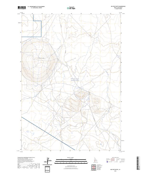
2024 Map of Big Foot Butte
USGS Topo · Published 2024About this map
Big Foot Butte rises above a landscape defined by its strategic military and natural features in this modern topographical survey. The Orchard Combat Training Center occupies a significant portion of the terrain, illustrating the ongoing utility of these high desert plains for defense operations. Settlement is virtually absent, replaced by a network of specialized access routes like S Range Rd and traditional land divisions of the Public Land Survey System, including t2s r2e and t3s r3e. Water is a scarce and distinctive resource in this arid environment, marked by the presence of ephemeral or localized features such as Tadpole Lake and Wind Butte Lakes. The drainage of Rabbit Creek provides a natural contrast to the prominent butte and military infrastructure, showing how the physical geography of Ada County continues to dictate land use in the twenty-first century.
Find a feature on this map
10 named features on this map. Tap any name to fly to it.
Don’t see what you’re looking for? This feature index may not catch every label — zoom into the map to look around manually.
Map Details
Editions of this 2024 Big Foot Butte Map
This is the sole edition of this map. No revisions or reprints were ever made.
Other maps of this area

1892 · Bisuka
USGS Topo · 1:125,000

1894 · Bisuka
USGS Topo · 1:125,000

1947 · Jackass Butte
USGS Topo · 1:24,000

1947 · Wild Horse Butte
USGS Topo · 1:24,000

1947 · Dorsey Butte
USGS Topo · 1:24,000

1948 · Castle Butte
USGS Topo · 1:24,000

1948 · Big Foot Butte
USGS Topo · 1:24,000

1948 · Wild Horse Butte
USGS Topo · 1:24,000

1948 · Jackass Butte
USGS Topo · 1:24,000

1948 · Dorsey Butte
USGS Topo · 1:24,000