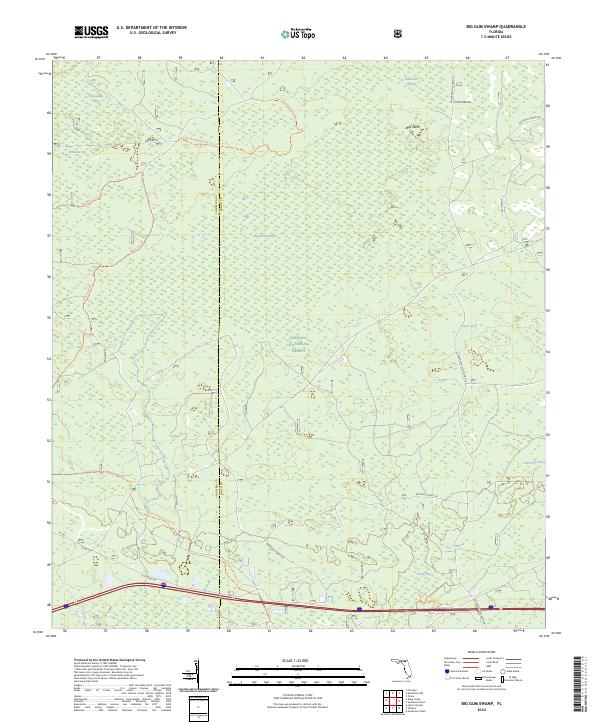
2024 Map of Big Gum Swamp
USGS Topo · Published 2024About this map
Big Gum Swamp Wilderness dominates this portion of the Osceola National Forest, marking the boundary between Columbia and Baker counties. This landscape is defined by its extensive wetland systems, including named depressions like Impassable Bay, Williams Bay, and Fanny Bay. The terrain features subtle rises known as "islands," such as Big Island and Cross Island, which provide relief within the surrounding Buckhead Swamp. A network of unpaved forest routes and trails provides access to the interior, most notably the Florida National Scenic Trl and the Osceola Wilderness Trl. In the southern reaches, the Fanny Bay Trl skirts the edge of its namesake wetland, while the long stretch of Seventeen Mile Camp Rd serves as a primary north-south artery through the forested backcountry.
Find a feature on this map
23 named features on this map. Tap any name to fly to it.
Don’t see what you’re looking for? This feature index may not catch every label — zoom into the map to look around manually.
Map Details
Editions of this 2024 Big Gum Swamp Map
This is the sole edition of this map. No revisions or reprints were ever made.
Other maps of this area

1954 · Valdosta
USGS Topo · 1:250,000

1958 · Valdosta
USGS Topo · 1:250,000

1959 · Valdosta
USGS Topo · 1:250,000

1961 · Deep Creek
USGS Topo · 1:24,000

1962 · Lake City East
USGS Topo · 1:24,000

1963 · Olustee
USGS Topo · 1:24,000

1963 · Sanderson South
USGS Topo · 1:24,000

1969 · Sanderson NW
USGS Topo · 1:24,000

1969 · Sanderson North
USGS Topo · 1:24,000
1969 · Fairview
USGS Topo · 1:24,000