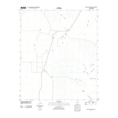
2010 Map of Big Hatchet Peak
USGS Topo · Published 2010About this map
Big Hatchet Peak and the surrounding Big Hatchet Mountains dominate this arid landscape in the bootheel of New Mexico. The map illustrates a remote ranching economy defined by scattered outposts such as Lambert Ranch, Petersons Ranch, and Old Hatchet Ranch, all connected by a network of county roads including County Rd-C018. The terrain transitions sharply from the flat Playas Valley in the west to the deeply incised canyons of the range, including Chaney Canyon and Horse Pasture Canyon. Between the major massifs, Hatchet Gap provides a natural corridor for travelers moving between the valleys. The naming of high points like Zeller Peak and dramatic landforms such as Ram Gorge highlights the significance of these peaks as landmarks for the isolated ranching communities that operate in this high-desert environment.
Find a feature on this map
25 named features on this map. Tap any name to fly to it.
Don’t see what you’re looking for? This feature index may not catch every label — zoom into the map to look around manually.
Map Details
Editions of this 2010 Big Hatchet Peak Map
This is the sole edition of this map. No revisions or reprints were ever made.
Other maps of this area

1918 · Big Hatchet Peak
USGS Topo · 1:62,500

1918 · Hachita
USGS Topo · 1:62,500

1918 · Walnut Wells
USGS Topo · 1:62,500

1918 · Playas
USGS Topo · 1:62,500

1919 · Playas
USGS Topo · 1:62,500

1923 · Walnut Wells
USGS Topo · 1:62,500

1955 · Douglas
USGS Topo · 1:250,000

1959 · Douglas
USGS Topo · 1:250,000

1961 · Douglas
USGS Topo · 1:250,000

1964 · Douglas
USGS Topo · 1:250,000