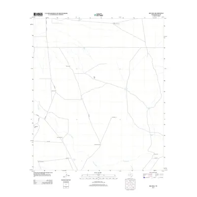
2012 Map of Big Hill
USGS Topo · Published 2012About this map
Big Hill and Johnson Hill anchor this expanse of Reeves County, defining a landscape shaped by water management and ranching infrastructure in the early 21st century. The drainage of Cottonwood Cr meanders through the southern half of the quadrangle, where a network of county roads like Co RD 222 provides access to scattered landmarks. The scarcity of surface water is evident in the prevalence of named tanks and windmills, which serve as the primary human imprints on this arid terrain.
Find a feature on this map
23 named features on this map. Tap any name to fly to it.
Don’t see what you’re looking for? This feature index may not catch every label — zoom into the map to look around manually.
Map Details
Editions of this 2012 Big Hill Map
This is the sole edition of this map. No revisions or reprints were ever made.
Other maps of this area

1921 · Toyah
USGS Topo · 1:125,000

1954 · Pecos
USGS Topo · 1:250,000

1957 · Pecos
USGS Topo · 1:250,000

1968 · W T Ranch
USGS Topo · 1:24,000
1968 · Halamicek Ranch
USGS Topo · 1:24,000

1968 · Mentone SW
USGS Topo · 1:24,000

1970 · Hermosa SW
USGS Topo · 1:24,000

1970 · Big Hill
USGS Topo · 1:24,000

1970 · Toyah
USGS Topo · 1:24,000
1970 · Hermosa
USGS Topo · 1:24,000