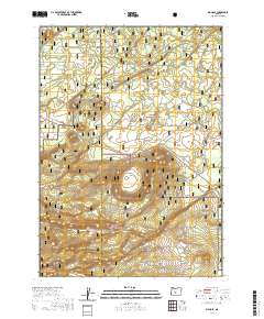
2020 Map of Big Hole
USGS Topo · Published 2020About this map
Big Hole, a massive maar crater, dominates this volcanic landscape along the border of Klamath and Lake Counties. This 2020 survey illustrates the meeting point of the Deschutes National Forest and the Fremont National Forest, where high-altitude forestry management defines the terrain. The central crater is flanked by Big Hole Butte, while other volcanic features like Hooligan Hill and Mowich Spring Butte punctuate the surrounding forested plateaus. The map details the complex network of forest service roads and section lines within Township 24 South, Range 11 East and adjacent ranges, showing how modern resource management and geographic boundaries intersect in this unique geological basin.
Find a feature on this map
11 named features on this map. Tap any name to fly to it.
Don’t see what you’re looking for? This feature index may not catch every label — zoom into the map to look around manually.
Map Details
Editions of this 2020 Big Hole Map
This is the sole edition of this map. No revisions or reprints were ever made.
Other maps of this area

1931 · Newberry Crater
USGS Topo · 1:125,000

1935 · Newberry Crater
USGS Topo · 1:125,000

1955 · Crescent
USGS Topo · 1:250,000

1957 · Crescent
USGS Topo · 1:250,000

1958 · Crescent
USGS Topo · 1:250,000
1963 · Spring Butte
USGS Topo · 1:24,000
1963 · Moffitt Butte
USGS Topo · 1:24,000

1970 · Crescent
USGS Topo · 1:250,000

1979 · Crescent
USGS Topo · 1:100,000
1981 · Wickiup Spring
USGS Topo · 1:24,000