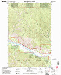
1999 Map of Big Hole Peak
USGS Topo · Published 2003About this map
Clark Fork cuts through the southern portion of this landscape, creating a distinct valley corridor beneath the heights of Big Hole Peak. This 1999 revision of the Sanders County terrain highlights the complex drainage systems of the Lolo National Forest, where waterways like Weeksville Creek and Tepee Creek flow through deeply incised valleys toward the river. The map documents the geographical relationship between the high timberlands and the Thompson Falls Plains, offering a clear view of the Fifth Standard Parallel North as it bisects the forest. Localized features such as the Gravel Pit and Swamp Lake provide specific points of reference for those studying the physical development and land use patterns within the Ranger District at the close of the twentieth century.
Find a feature on this map
20 named features on this map. Tap any name to fly to it.
Don’t see what you’re looking for? This feature index may not catch every label — zoom into the map to look around manually.
Map Details
Editions of this 1999 Big Hole Peak Map
This is the sole edition of this map. No revisions or reprints were ever made.
Other maps of this area

1918 · St Regis
USGS Topo · 1:125,000

1919 · St. Regis
USGS Topo · 1:125,000

1937 · Thompson Falls
USGS Topo · 1:125,000

1956 · St Regis
USGS Topo · 1:62,500

1956 · Wallace
USGS Topo · 1:250,000

1959 · Plains
USGS Topo · 1:62,500

1960 · Wallace
USGS Topo · 1:250,000

1964 · Calico Creek
USGS Topo · 1:24,000

1964 · Eddy Mountain
USGS Topo · 1:24,000
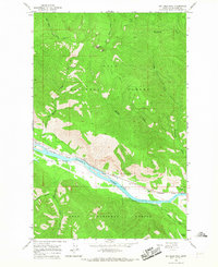
1964 · Big Hole Peak
USGS Topo · 1:24,000