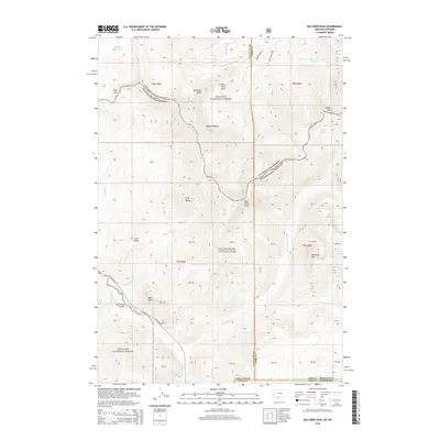
2014 Map of Big Horn Peak
USGS Topo · Published 2014About this map
Big Horn Peak and the surrounding heights of the Gallatin Range dominate this 2014 survey along the high-elevation boundary of Yellowstone National Park and Gallatin National Forest. The landscape is defined by its complex drainage network, where the headwaters of the Gallatin River and Specimen Creek descend from prominent ridges like Specimen Ridge and Meldrum Mountain. Significant alpine features such as Shelf Lake and Buffalo Horn Lakes are tucked into the high country, while Daly Pass provides a navigable break in the northern terrain. Down in the valley, the Gallatin Road corridor and the Black Butte Bridge mark the primary infrastructure linking this wilderness to the wider region. The map highlights the intersection of Gallatin and Park Counties at the Montana-Wyoming state line, illustrating the administrative layers over this high-mountain geography.
Find a feature on this map
38 named features on this map. Tap any name to fly to it.
Don’t see what you’re looking for? This feature index may not catch every label — zoom into the map to look around manually.
Map Details
Editions of this 2014 Big Horn Peak Map
This is the sole edition of this map. No revisions or reprints were ever made.
Other maps of this area

1885 · Gallatin
USGS Topo · 1:125,000

1885 · Gallatin
USGS Topo · 1:125,000

1888 · Three Forks
USGS Topo · 1:250,000

1891 · Livingston
USGS Topo · 1:250,000

1893 · Livingston
USGS Topo · 1:250,000

1894 · Three Forks
USGS Topo · 1:250,000

1895 · Three Forks
USGS Topo · 1:250,000

1901 · Gallatin
USGS Topo · 1:125,000

1908 · Gallatin
USGS Topo · 1:125,000

1911 · Gallatin
USGS Topo · 1:125,000