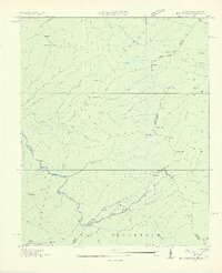
1927 Map of Big Junction
USGS Topo · Published 1927About this map
Tellico River and the Beaverdam River define the lower elevations of this high-mountain borderland between Tennessee and North Carolina. At the time of this Tennessee Valley Authority survey, the area was largely managed as the Cherokee National Forest and Nantahala National Forest. The map documents a primitive network of ridge-top paths and gaps that connected remote outposts such as Whigg Cabin, located just below Haw Knob.
Find a feature on this map
77 named features on this map. Tap any name to fly to it.
Don’t see what you’re looking for? This feature index may not catch every label — zoom into the map to look around manually.
Map Details
Editions of this 1927 Big Junction Map
2 editions found
Other maps of this area

1893 · Murphy
USGS Topo · 1:125,000

1914 · Murphy
USGS Topo · 1:125,000

1927 · Big Junction
USGS Topo · 1:24,000

1933 · Haw Knob
USGS Topo · 1:48,000

1933 · Whiteoak Flats
USGS Topo · 1:24,000

1933 · Bald River Falls
USGS Topo · 1:24,000

1933 · Rafter
USGS Topo · 1:24,000

1934 · McDaniel Bald
USGS Topo · 1:24,000

1934 · Unaka
USGS Topo · 1:24,000

1934 · Murphy
USGS Topo · 1:48,000