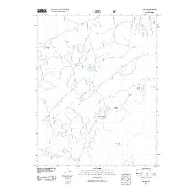
2011 Map of Big Lake
USGS Topo · Published 2011About this map
The Aquarius Plateau defines this high-elevation landscape, where a sophisticated network of springs and reservoirs supported land use in the early twenty-first century. Water management is central to the area's geography, evidenced by the Roundy Reservoir Dam and the Indian Spring Reservoir. These man-made features sit alongside natural catchments like Big Lake, Pelham Lake, and Lake Philo. The terrain is marked by distinct flats and draws, such as Rockwell Flat and Allen Well Draw, which likely served as key navigational or grazing markers. Transportation across this portion of Garfield County relied on established forest routes, including Forest Rd 157 and USFS Rd 154, which navigate the rises of Pelham Knoll and the descent toward Willow Bottom.
Find a feature on this map
24 named features on this map. Tap any name to fly to it.
Don’t see what you’re looking for? This feature index may not catch every label — zoom into the map to look around manually.
Map Details
Editions of this 2011 Big Lake Map
This is the sole edition of this map. No revisions or reprints were ever made.
Other maps of this area

1885 · Fish Lake
USGS Topo · 1:250,000

1886 · Escalante
USGS Topo · 1:250,000

1896 · Fish Lake
USGS Topo · 1:250,000

1953 · Loa 4 NE
USGS Topo · 1:24,000

1956 · Escalante
USGS Topo · 1:250,000

1956 · Salina
USGS Topo · 1:250,000

1960 · Escalante
USGS Topo · 1:250,000

1960 · Salina
USGS Topo · 1:250,000

1962 · Salina
USGS Topo · 1:250,000

1964 · Barker Reservoir
USGS Topo · 1:24,000