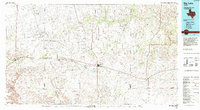
1986 Map of Big Lake
USGS Topo · Published 1993About this map
The Big Lake Oil Field and the surrounding Permian Basin energy landscape dominate this mid-1980s mid-scale study of West Texas. The map illustrates the industrial footprint of petroleum extraction, with extensive networks of access roads and pipelines serving the Stiles Oil Field, Benedum Oil Field, and Ketchum Mountain Oil Field. This resource-driven economy is tied together by the Atchison Topeka and Santa Fe railroad, which parallels Highway 67 through a string of settlements including Texon, Santa Rita, and Best.
Find a feature on this map
62 named features on this map. Tap any name to fly to it.
Don’t see what you’re looking for? This feature index may not catch every label — zoom into the map to look around manually.
Map Details
Editions of this 1986 Big Lake Map
This is the sole edition of this map. No revisions or reprints were ever made.
Other maps of this area

1895 · Sherwood
USGS Topo · 1:125,000

1920 · Big Lake
USGS Topo · 1:62,500

1920 · Barnhart
USGS Topo · 1:62,500

1921 · Ketchum Mountain
USGS Topo · 1:62,500

1922 · Big Lake
USGS Topo · 1:62,500

1922 · Barnhart
USGS Topo · 1:62,500

1923 · Ketchum Mountain
USGS Topo · 1:62,500

1928 · Crane
USGS Topo · 1:125,000

1928 · Rankin
USGS Topo · 1:125,000

1929 · Sheffield
USGS Topo · 1:125,000