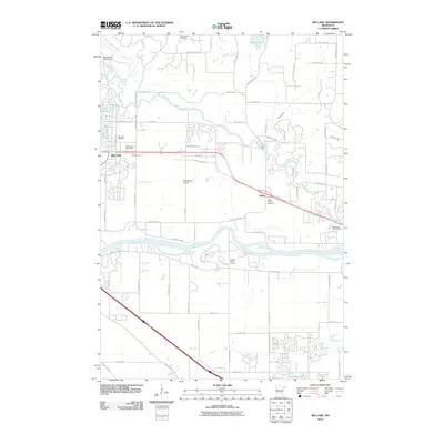
2010 Map of Big Lake
USGS Topo · Published 2010About this map
The Mississippi River and Elk River define the hydraulic character of this Sherburne County landscape, where riparian corridors meet the growing residential footprint of Big Lake. The map reveals a community structured by its water bodies, including Lake Mitchell, Beaudry Lake, and Hunters Lake, alongside the specialized aviation grounds of Hook Spray Airport. For genealogists, the survey identifies several key burial sites such as Greenwood Cemetery, Big Lake Cemetery, and the Bailey Station Cemetery, which sits near the settlement of Bailey. The presence of the Big Lake Post Office and multiple recreational sites like Pinewood Golf Course and the Shady River Campgrounds reflects the area's dual identity as both a suburban center and a gateway to outdoor recreation in the central Minnesota river valleys.
Find a feature on this map
78 named features on this map. Tap any name to fly to it.
Don’t see what you’re looking for? This feature index may not catch every label — zoom into the map to look around manually.
Map Details
Editions of this 2010 Big Lake Map
This is the sole edition of this map. No revisions or reprints were ever made.
Other maps of this area

1909 · Rockford
USGS Topo · 1:62,500

1953 · Stillwater
USGS Topo · 1:250,000

1955 · Stillwater
USGS Topo · 1:250,000

1958 · Stillwater
USGS Topo · 1:250,000

1958 · Rockford
USGS Topo · 1:62,500

1958 · Buffalo
USGS Topo · 1:62,500

1961 · Big Lake
USGS Topo · 1:24,000

1961 · Orrock
USGS Topo · 1:24,000

1961 · Lake Fremont
USGS Topo · 1:24,000

1961 · Elk River
USGS Topo · 1:24,000