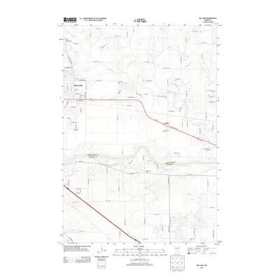
2013 Map of Big Lake
USGS Topo · Published 2013About this map
Mississippi River and Elk River define the southern and central geography of this Sherburne County landscape, where water has long dictated the patterns of settlement and recreation. The city of Big Lake sits at a critical junction of transportation and nature, adjacent to its namesake lake and Lake Mitchell. Following the path of Us-10, the community of Bailey serves as another historic anchor point, marked by the Bailey Station Cem. The northern reaches are characterized by the meandering Saint Francis River near the Shady River Campgrounds, alongside numerous smaller water bodies like Birch Lake and Tibbits Brook. This mapping captures the region's character as a river-valley corridor where residential expansion from the Twin Cities meets the more traditional agricultural and lakeside landscapes of central Minnesota.
Find a feature on this map
73 named features on this map. Tap any name to fly to it.
Don’t see what you’re looking for? This feature index may not catch every label — zoom into the map to look around manually.
Map Details
Editions of this 2013 Big Lake Map
This is the sole edition of this map. No revisions or reprints were ever made.
Other maps of this area

1909 · Rockford
USGS Topo · 1:62,500

1953 · Stillwater
USGS Topo · 1:250,000

1955 · Stillwater
USGS Topo · 1:250,000

1958 · Stillwater
USGS Topo · 1:250,000

1958 · Rockford
USGS Topo · 1:62,500

1958 · Buffalo
USGS Topo · 1:62,500

1961 · Big Lake
USGS Topo · 1:24,000

1961 · Orrock
USGS Topo · 1:24,000

1961 · Lake Fremont
USGS Topo · 1:24,000

1961 · Elk River
USGS Topo · 1:24,000