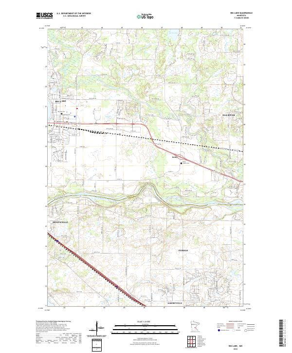
2022 Map of Big Lake
USGS Topo · Published 2022About this map
The Mississippi River forms a significant geographical boundary on this sheet, separating the communities of Big Lake and Monticello. This area, situated along the border of Sherburne and Wright counties, demonstrates a landscape defined by its glacial history, with numerous water bodies like Birch Lake, Beaudry Lake, and Preusse Lake dotting the northern half. The presence of the Elk River and Saint Francis River further highlights the importance of water systems to the region's development.
Find a feature on this map
148 named features on this map. Tap any name to fly to it.
Don’t see what you’re looking for? This feature index may not catch every label — zoom into the map to look around manually.
Map Details
Editions of this 2022 Big Lake Map
This is the sole edition of this map. No revisions or reprints were ever made.
Other maps of this area

1909 · Rockford
USGS Topo · 1:62,500

1953 · Stillwater
USGS Topo · 1:250,000

1955 · Stillwater
USGS Topo · 1:250,000

1958 · Stillwater
USGS Topo · 1:250,000

1958 · Rockford
USGS Topo · 1:62,500

1958 · Buffalo
USGS Topo · 1:62,500

1961 · Big Lake
USGS Topo · 1:24,000

1961 · Orrock
USGS Topo · 1:24,000

1961 · Lake Fremont
USGS Topo · 1:24,000

1961 · Elk River
USGS Topo · 1:24,000