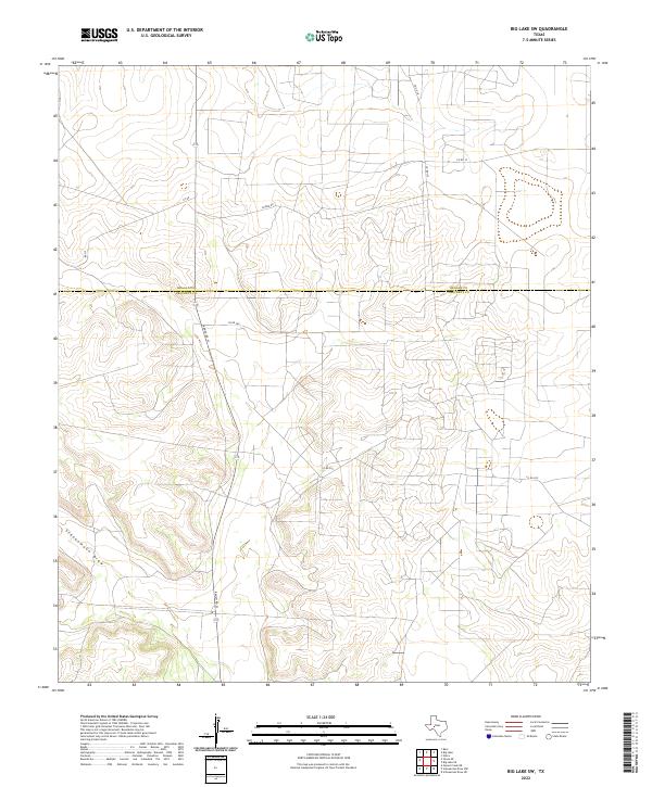
2022 Map of Big Lake SW
USGS Topo · Published 2022About this map
Schneemann Draw cuts through this West Texas landscape where the boundary between Reagan and Crockett counties is formally established. The terrain is defined by a network of rural roads and ranch paths that facilitate movement across the arid drainage basins. This 2022 survey illustrates a region where transportation is dictated by the natural contours of the land, centered around the primary corridor of Ranch Rd 33. Local connectivity is maintained through an system of named tracks including Co Rd 205, Friend Rd, and Chico Ln. The map's close contour intervals reveal the subtle topographic shifts that characterize the high plateau south of the town of Big Lake, where the sparse road names often reflect the heritage of the families and ranching operations that have long stewarded this specific corner of the Permian Basin.
Find a feature on this map
9 named features on this map. Tap any name to fly to it.
Don’t see what you’re looking for? This feature index may not catch every label — zoom into the map to look around manually.
Map Details
Editions of this 2022 Big Lake SW Map
This is the sole edition of this map. No revisions or reprints were ever made.
Other maps of this area

1920 · Big Lake
USGS Topo · 1:62,500

1922 · Big Lake
USGS Topo · 1:62,500

1928 · Rankin
USGS Topo · 1:125,000

1929 · Sheffield
USGS Topo · 1:125,000

1954 · Sonora
USGS Topo · 1:250,000

1954 · San Angelo
USGS Topo · 1:250,000

1958 · Sonora
USGS Topo · 1:250,000

1958 · San Angelo
USGS Topo · 1:250,000

1965 · San Angelo
USGS Topo · 1:250,000

1967 · Owens Creek NE
USGS Topo · 1:24,000