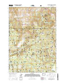
2014 Map of Big Mowich Mountain
USGS Topo · Published 2014About this map
Ochoco National Forest and Malheur National Forest converge at this high-altitude landscape along the boundary of Grant and Harney counties. The terrain is defined by prominent peaks including Big Mowich Mountain and Snow Mountain, with numerous water sources like Beaver Reservoir and the headwaters of South Fork Beaver Cr supporting the ecosystem. A dense network of forest service roads, such as Snow Mountain Rd and Donnelly Rd, provides access across the ridge lines. Hidden within the folds of the landscape are specific grazing and transit points like Lehman Meadow and Button Flat. The high concentration of named springs, including Timothy Spring, Silver Spring, and Adams Spring, highlights the critical importance of water management in these high Oregon forests.
Find a feature on this map
76 named features on this map. Tap any name to fly to it.
Don’t see what you’re looking for? This feature index may not catch every label — zoom into the map to look around manually.
Map Details
Editions of this 2014 Big Mowich Mountain Map
This is the sole edition of this map. No revisions or reprints were ever made.
Other maps of this area

1932 · Dayville
USGS Topo · 1:125,000

1936 · Dayville
USGS Topo · 1:125,000

1955 · Burns
USGS Topo · 1:250,000

1955 · Canyon City
USGS Topo · 1:250,000

1958 · Burns
USGS Topo · 1:250,000

1959 · Burns
USGS Topo · 1:250,000

1959 · Canyon City
USGS Topo · 1:250,000

1959 · Sawtooth Creek
USGS Topo · 1:62,500

1961 · Delintment Lake
USGS Topo · 1:62,500

1961 · Izee
USGS Topo · 1:62,500