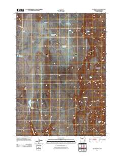
2011 Map of Big Mud Flat
USGS Topo · Published 2011About this map
Mud Flat Ranch and a series of private water management features define this high desert landscape in southeastern Oregon. This portion of Malheur County is characterized by significant topographical shifts, from the broad expanse of Big Mud Flat to the dramatic elevation changes at Owyhee Breaks and Wrangle Basin. The distribution of water is a central theme of the map, evidenced by numerous named reservoirs and dams such as the David Kent Dam and Black Canyon Creek Dam. Many of these features, including Knottingham Reservoir and Harry Page Reservoir, appear to be named for local individuals or ranching families, providing valuable clues for genealogical research. Connectivity in this remote region is maintained by unpaved routes like Antelope Flat Rd and Turner Rd, which navigate the drainages of Black Canyon Creek.
Find a feature on this map
19 named features on this map. Tap any name to fly to it.
Don’t see what you’re looking for? This feature index may not catch every label — zoom into the map to look around manually.
Map Details
Editions of this 2011 Big Mud Flat Map
This is the sole edition of this map. No revisions or reprints were ever made.
Other maps of this area

1955 · Boise
USGS Topo · 1:250,000

1958 · Boise
USGS Topo · 1:250,000

1962 · Boise
USGS Topo · 1:250,000

1967 · Diamond Butte
USGS Topo · 1:24,000

1967 · Quartz Mtn Basin
USGS Topo · 1:24,000

1969 · Jordan Craters North
USGS Topo · 1:24,000

1972 · Cedar Mountain
USGS Topo · 1:24,000

1972 · Big Mud Flat
USGS Topo · 1:24,000
1972 · Wall Rock Springs
USGS Topo · 1:24,000
1972 · Rinehart Canyon
USGS Topo · 1:24,000